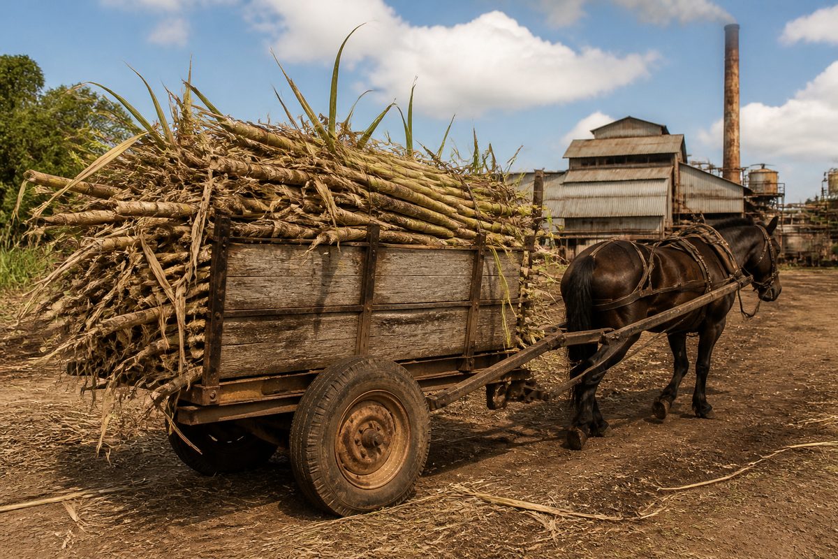
Helensvale began as a sugar plantation and became a suburb through planned housing, road building and stronger rail links. The change took more than a century. Arthur Robinson and Ernest White established the plantation during the 1800s, when the district was still rural. Large-scale housing development arrived in the 1970s. Later, the opening of Helensvale railway station helped turn the suburb into one of the northern Gold Coast's main transport points.
The story is easy to miss when looking at modern Helensvale, Queensland. Houses cover land once used for crops and grazing. A shopping center stands near major roads. Heavy rail and Light rail meet close to the suburb's commercial heart. Yet the old plantation still matters because it gave Helensvale its name and marked the first major attempt to use this land for commercial farming.
What was the Helensvale area like before suburban growth?
Before housing estates spread across the district, the land around present-day Helensvale formed part of a wet, lightly settled rural zone. Creeks ran through low ground, while woodland covered the higher areas. Travel was slow. Tracks could become difficult after rain, and farmers had limited ways to move crops to buyers.
The nearby coast was developing along a different path. Settlements closer to the Pacific Ocean gained attention for beaches, guest houses and later tourism. Inland areas remained tied to farming and timber work. This difference explains why Helensvale stayed rural long after coastal communities began to grow.
European settlement changed the district through land selection. Settlers cleared vegetation, fenced blocks and tested crops suited to the warm climate. Sugar attracted interest because it could produce a valuable crop from relatively small areas. It also demanded hard physical work, reliable water and access to a mill.
Early land use did not follow the neat boundaries seen on a current suburb map. Properties were broad rural holdings linked by rough routes. The identity of Helensvale grew from one of those holdings rather than from an early village or town centre.
Who created the sugar plantation?
Arthur Robinson and Ernest White are the two names most closely linked with the plantation that gave Helensvale its identity. During the 1800s, they took up land in the district and established a sugar-growing property called Helensvale.
The choice of sugar made sense on paper. The climate was warm, rainfall could be generous and the wider region already had agricultural promise. In practice, sugar farming was hard. Growers had to clear land, plant cane by hand and cut the mature crop. Cane also had to reach crushing equipment quickly after harvest. A weak transport route or spell of wet weather could reduce the value of months of work.
The plantation did not create a busy township. It was a working rural property in a scattered farming district. Even so, its name lasted while many other farm names disappeared. When planners and developers later needed a name for the new community, Helensvale offered a local link that was already tied to the land.
That is the central thread in Helensvale history. The modern suburb did not grow steadily outward from the plantation buildings. The plantation name survived a long rural period, then returned as the name of a planned residential area.
Why did sugar farming fade from the district?
Sugar production relied on more than fertile soil. A successful grower needed labour, milling access and dependable transport. Small or isolated plantations faced high costs. Flooding and poor drainage could damage fields, while changing prices could turn a promising crop into a loss.
Other parts of South East Queensland developed stronger sugar industries because farms could share mills and transport systems. The Helensvale district never gained the same dense network. Over time, mixed farming and grazing became practical uses for much of the land.
The decline of one plantation did not cause an immediate suburb to appear. For decades, the area remained open and sparsely settled. This long gap matters. Helensvale's development was not a simple move from cane rows to houses. The land passed through an extended rural stage before population growth made suburban construction worthwhile.
Many short accounts skip this period because little dramatic happened. Yet it explains why planners later found large areas that could be assembled for coordinated development. The lack of an old town grid gave them room to set out curved streets, housing precincts and shared open space on a broad scale.
What made the land attractive for a new suburb?
By the late 20th century, Gold Coast, Queensland was expanding beyond its older beachside centres. More people wanted homes within reach of coastal jobs without living on the narrow strip beside the sea. Improvements to the road network made northern inland land easier to reach.
Helensvale sat in a useful position between Brisbane and the central Gold Coast. It offered enough space for a large residential project, while major regional routes were close enough to support daily travel. The land was no longer valuable mainly for what it could grow. Its new value came from where it was.
Development began during the 1970s, with the first residents arriving as new streets and homes were completed. This was a planned change rather than the slow growth of an old farming village. Developers divided the land into residential areas and reserved sites for parks, schools and local services.
The suburb's form shows the ideas common in Australian Urban planning at the time. Curved streets reduced through traffic in housing areas. Cul-de-sacs created quieter pockets. Larger connecting roads carried cars toward shops and regional routes. Open space followed some waterways and low land that was less suitable for building.
This pattern brought benefits, but it also made the early suburb dependent on cars. Homes could sit a long walk from shops or public transport. Later investment in Rail transport helped correct that weakness, though distance from a station still shaped how residents moved around.
How did planners turn rural land into a working community?
Building houses was only one part of the task. A suburb needed drainage, safe roads and public spaces. Low-lying ground required care because water had moved through the area long before survey lines appeared. Development had to work around creeks and flood-prone land rather than treat every block as equal.
Services arrived in stages as the population grew. Schools gave families a reason to settle for the long term. Sporting grounds and parks created meeting points outside the home. Retail development reduced the need to travel south for basic purchases.
The shopping center became a practical anchor for the new suburb. It changed as the district gained more residents and drew shoppers from nearby communities. This commercial core helped Helensvale operate as more than a collection of housing estates.
The planned design also divided activities into clear zones. Homes occupied quieter internal streets, while larger retail and transport uses gathered near main roads. This separation reduced some local traffic conflicts. It also meant the suburb lacked the single walkable main street found in older towns.
A common mistake is to judge that layout by current planning goals. The original design reflected a period when private cars shaped suburban life. What seems spread out now was sold as space, calm streets and easy road access. Understanding that goal makes the present map easier to read.
Why did the railway change Helensvale's role?
The opening of the Helensvale railway in the 1990s gave the suburb a stronger link with Brisbane and the wider Gold Coast. Helensvale railway station became a practical transfer point for commuters who might otherwise have driven the full distance.
A Train station does more than provide a platform. It changes how nearby land works. Bus routes can meet there. Retail gains passing customers. Housing near the line becomes more useful to people who commute. In Helensvale, the station helped shift the suburb from a car-based residential edge into a regional transport node.
The railway also restored a form of access that the old plantation had lacked. Sugar growers needed to move a heavy crop through a weak local transport system. Modern residents gained a fast passenger route linking jobs and services across South East Queensland. The purpose was different, but transport again shaped the value of the land.
Rail access did not replace road travel. Many local trips still required a car, especially from streets far from the station. The key change was choice. A resident could drive to the station, use a feeder service or reach it from a nearby home, then continue along the main line.
How did light rail create another turning point?
The arrival of Light rail at Helensvale in 2017 linked the heavy rail network with the coastal tram route. Passengers could change at Helensvale railway station and continue toward major coastal destinations without relying on a car for the whole trip.
This connection made Helensvale unusual within the city. It joined regional train travel with an urban service built for shorter trips along a busy coastal corridor. The station area became a gateway between inland residential districts and the developed strip closer to the Pacific Ocean.
The link also revealed how the suburb's role had changed. The plantation sat on the edge of a thinly settled farming region. The planned suburb began as a northern residential community. The rail interchange now serves people moving across a much larger urban area.
That growth followed no single master plan covering the whole 150-year story. Each phase answered a different need. Farmers sought productive land. Housing developers responded to population growth. Transport agencies connected communities that had spread across a wide area.
Where can the old history still be seen?
Few obvious plantation features remain in daily view. The strongest trace is the name Helensvale itself. It appears on road signs, maps and the station, carrying a rural property name into a dense urban setting.
The shape of the land offers further clues. Waterways and low ground still influence parks, drainage corridors and building patterns. These natural limits affected the plantation and later guided suburban design. Modern engineering changed water flow, but it could not erase the area's basic terrain.
Street layouts show the later layer of history. Curves, loops and cul-de-sacs point to 1970s suburban design rather than a 19th-century town survey. Larger roads and commercial sites show how planners expected residents to travel and shop.
The station precinct adds the newest clear layer. Tracks, parking areas and tram platforms record Helensvale's move into a connected metropolitan region. Seen together, the name, landform and street pattern tell more of the story than a single old building could.
What does Helensvale's change tell us about the Gold Coast?
Helensvale shows that Gold Coast growth was never limited to beach towers and tourism. Inland farms also became part of the city. Large rural blocks supplied space for homes as population pushed north and west.
Its history also shows how transport can redefine the same place more than once. Poor crop transport limited the early sugar venture. Roads enabled planned housing. Rail later gave the suburb a role beyond its residential streets.
The name links those changes without proving a direct line of continuous growth. Arthur Robinson and Ernest White would not have recognised the current suburb as an expanded version of their plantation. The land changed purpose because the region around it changed.
Look at Helensvale as a set of layers: the plantation name, the planned street pattern and the railway interchange. That single reading reveals how rural land became a Gold Coast suburb.